What's in our toolkit?
There are many ways we can make our streets safer for everyone, no matter if they're walking, biking, riding the bus, or driving. Learn about some of our tools below and think about where you've seen them - or where they might make sense - in your neighborhood.
Signalization Practices
We can use traffic signals to make getting around safer and easier for everyone. Traffic signals separate different modes and directions of travel in space and time. Explore some ways we can change our traffic signals below.
Leading Pedestrian Intervals
A leading pedestrian interval (LPI) gives people crossing a street a 3-7 second head start before the parallel traffic light turns green. LPIs improve visibility, increase driver compliance, and reduce conflicts between different road users in crosswalks.
We will prioritize LPIs at intersections where there are high turning volumes, high pedestrian volumes, visibility constraints, or a history of crashes between turning vehicles and crossing pedestrians.
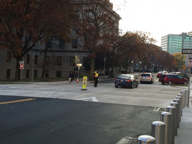
No Right on Red
When drivers turn right on red, they often focus on finding a gap in traffic rather than people crossing. To see better, drivers typically creep forward and block the crosswalk. We can restrict right turns on red to reduce conflicts between people walking and driving when appropriate.
We will prioritize this change near schools and in high pedestrian areas.
Pedestrian Signal Heads
Installing pedestrian signal heads helps people to better gauge how long they have to cross the street. It also increases accessibility for people with visual or other impairments. We can prioritize installation and upgrades near schools and in high pedestrian areas.
Shorter Signal Cycles
Sometimes, it feels like a light takes forever to change. This can lead to people crossing without a walk signal. We can shorten the length of time it takes for an intersection to cycle through all directions. This can increase pedestrian compliance and reduce waiting times, and also makes the wait shorter for people biking and driving. We've started implementing this at some intersections downtown already. We will prioritize this change at intersections with high pedestrian activity.
Signal Coordination and Progression
We can time a series of signals to work in progression and regulate vehicle speeds – making crashes less serious if/when they do happen. These can work well on streets with strong directional traffic (i.e., streets used to commute towards downtown). We can also use signal progression on streets on our bike network so that people traveling between 10 and 15 miles per hour – including people biking – hit green lights.
Bike Infrastructure
We can upgrade and improve the visibility, safety, and legibility of our bikeways. Bike lanes make streets safer for everyone – no matter how they are travelling. You can learn more about types of bikeways.
Bike Signals
Bike signals separate out bike movements to reduce conflicts with vehicles. We have a bike signal at the intersection of the Detroit Superior Bridge and Huron Road for people on bikes going east.
Bike Boxes
Bike boxes provide a designated place for people on bikes to queue at the front of traffic, increasing visibility to drivers. Bike boxes also reduce vehicles pulling onto and blocking crosswalks. We can include bike boxes at some intersections as we expand and improve our bike network.
Green Paint
Green paint can increase the visibility of bike lanes to drivers. We can use green paint through intersections to reduce conflicts.
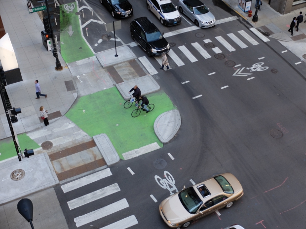
Protected Intersections
Protected intersections use curb extensions to reduce potential conflicts between people biking and vehicles. They also shorten crossing distances and reduce curb radii, slowing vehicle turning speeds. We will consider this approach at some intersections.
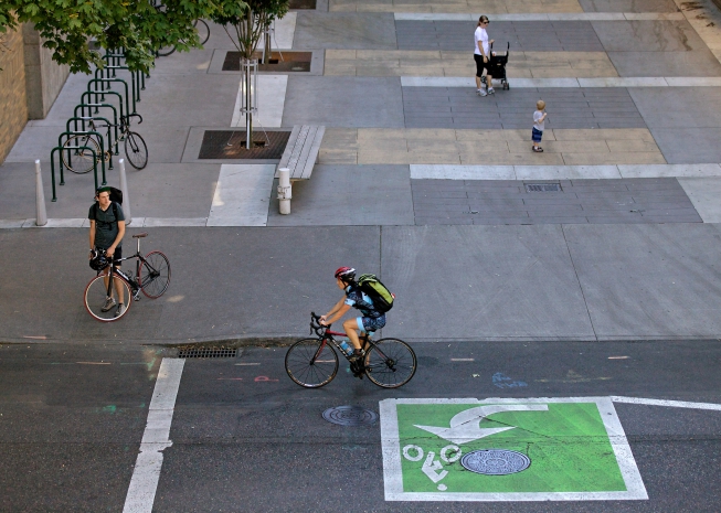
Two Stage Turn Boxes
Two stage left turn boxes allow people riding bikes to take a turn in two phases, rather than navigating out of the bike lane to use a vehicular left turn lane. Using a vehicular left turn lane is uncomfortable for many people biking, and can be a barrier to riding a bike.
Rather than using a vehicular left turn lane, a person riding a bike continues straight through the intersection, stopping in a green turn box. The person rotates their bike 60 degrees to the left, and proceeds forward when the light facing them turns green.
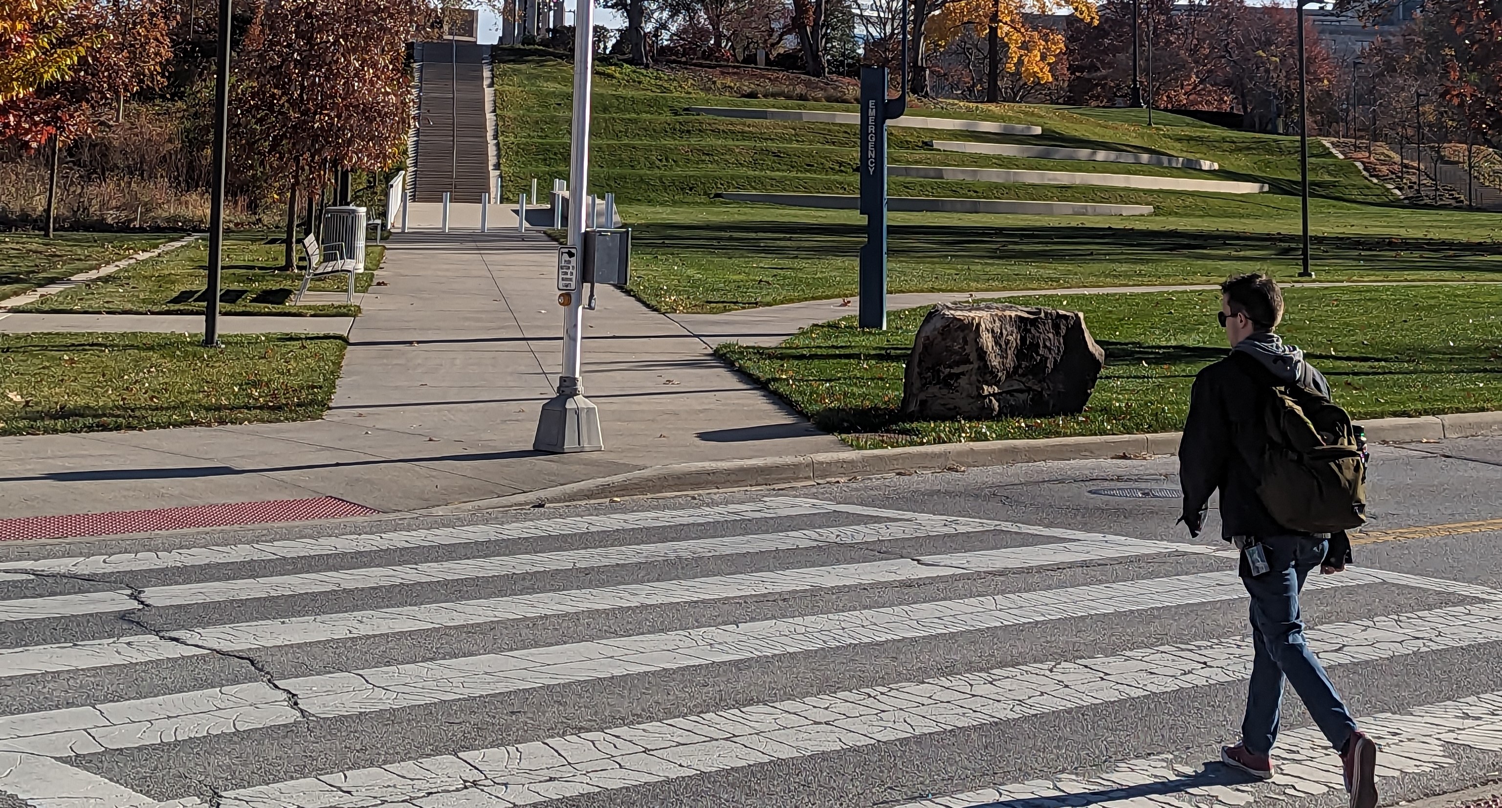
Crosswalks
Crosswalks help people to cross the street. We can increase visibility and safety at crosswalks in multiple ways.
Clear Corners (Daylighting)
Parked or stopped vehicles can reduce the visibility of other people driving, biking, or waiting to cross the street. When we restrict parking near an intersection, mid-block crosswalk, or driveway, drivers can better see approaching vehicles or people crossing the street. This reduces conflict and increases yielding.
We use striping and no parking signage to mark off these zones, and can use plastic delineators to "harden" these areas.
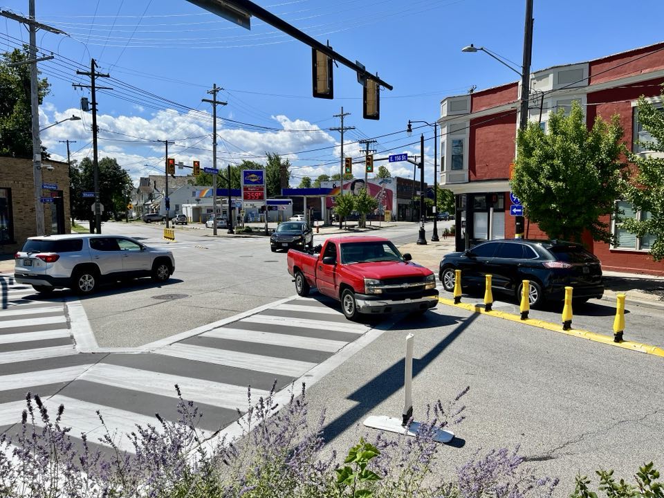
Curb Extension
Curb extensions are an extension of the curb at an intersection, crossing, or bus stop. They are sometimes called bulb or bump outs . They can slow vehicle speeds, shorten crossing distances, and improve sight lines for pedestrians and drivers approaching crosswalks . They also make sure that a bus can pull close enough to a curb to be accessible for anyone getting on or off the bus. These are most appropriate on streets with on-street parking.
In Cleveland, we have pin on curb extensions on Mayfield Road in Little Italy and on Larchmere. We also have fully attached curb extensions on East 12th Street.
Half Signal
A half signal is a normal traffic light is placed away from an intersection at the middle of a block. These are often used at frequent crossing locations and near bus stops, and usually require people waiting to push a button for the light to change. When a half signal turns red, it creates a designated stop in traffic for people to cross the street safely.
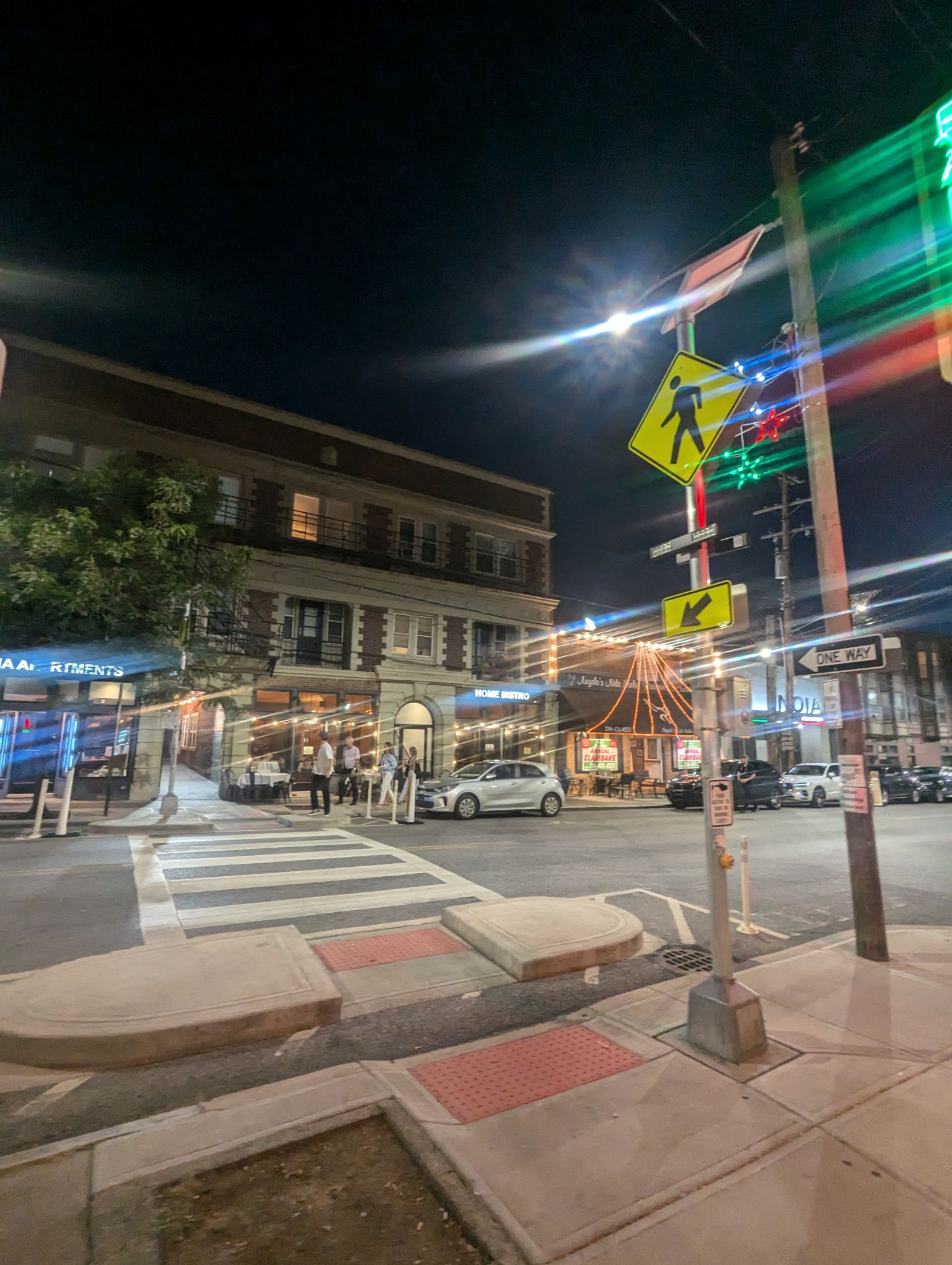
High Visibility Crosswalk
We typically stripe crosswalks with one line on either side, but we can upgrade the striping to look like a ladder to increase visibility. We must prioritize where and how many crosswalks we upgrade to make sure we can maintain them over time. Using pavers or bricks in a crosswalk can reduce visibility while also reducing accessibility for people with visual impairments or who use mobility devices.
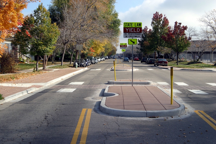
Pedestrian Refuge Island
A pedestrian refuge island gives people a place to stop, rest, and look for vehicles coming from the opposite direction before continuing across the street. They can reduce vehicle travel speeds and reduce crossing distance for pedestrians. Pedestrian refuge islands are often easiest to install on streets that already have a center turn lane.
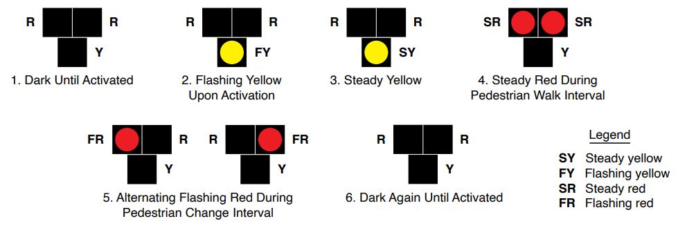
Pedestrian Hybrid Beacon (PHB) or HAWK
A Pedestrian Hybrid Beacon (PHB), or HAWK, can be used to support safe crossings for pedestrians on wider or higher-speed roadways. When a person pushes a button to cross, lights flash yellow, turn solid yellow, then turn solid double red. A pedestrian walk signal is displayed for people waiting to cross, and when the crosswalk starts to count down the red lights begin to flash.
You can find existing HAWKs on Superior Avenue downtown, on St. Clair Avenue just east of West 3rd Street, and on Clifton Avenue near West 116th Street.
Raised Crosswalk
A raised crossing brings a crosswalk up to sidewalk height, making it easier and more accessible for people to cross. This decreases vehicle speeds as they approach the crosswalk, increasing the chances that a driver will yield to people waiting to cross. Raised crossings are more expensive and complicated to install than speed humps or speed tables because they impact drainage. We will consider raised crossings as part of other construction projects. We'll prioritize them on and along streets with side paths or separated bike lanes, at channelized right turns and near roundabouts, and at intersections where we must maintain large turn radii to accommodate trucks.
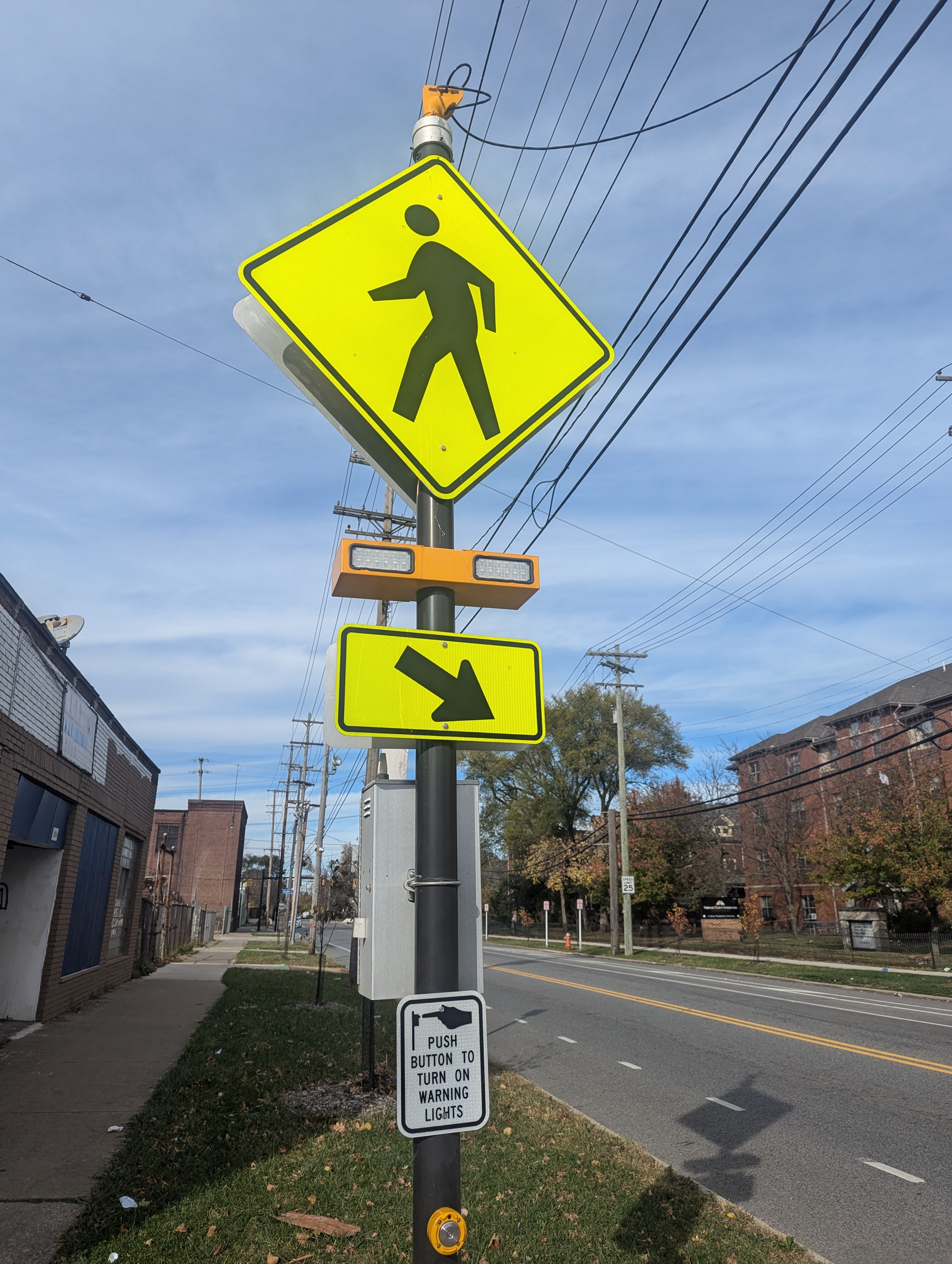
Rectangular Rapid Flashing Beacon (RRFB)
RRFBs are push button operated rectangular flashing lights. We can install RRFBs on either side of a mid-block crosswalk to alert drivers of people crossing the street.
RRFBs often rely on solar power to operate. During cloudy Cleveland winters, they may run out of power. If you see an RRFB that's not working, report it to Cleveland 311.
Other Street Safety Tools
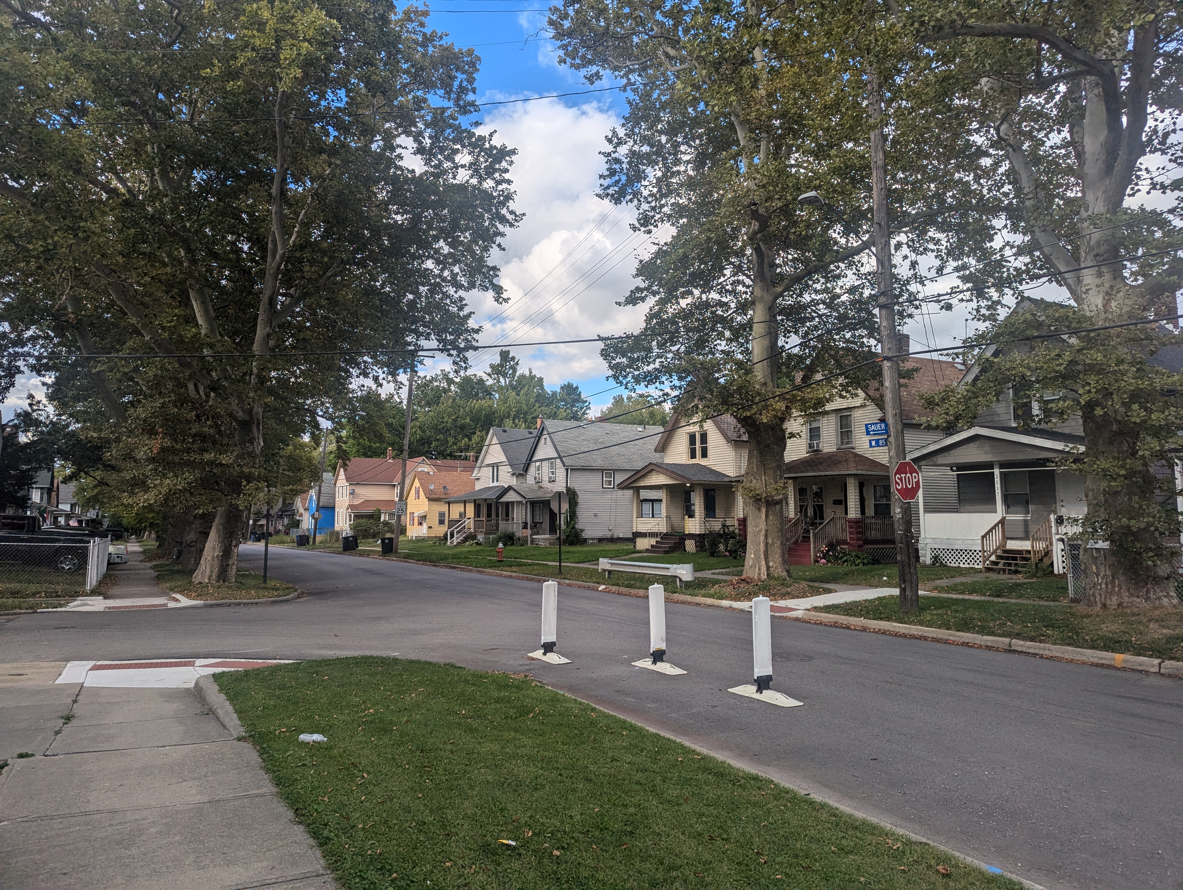
Chicane
Chicanes are alternating curb extensions on residential or low volume downtown street. Chicanes narrow the roadway and require drivers to navigate around slight curves. They have been proven to reduce traffic speeds.
We installed our first temporary chicanes on W 85th Street north of Lorain Avenue in 2024.
Hardened Centerline
We can use centerline hardening to slow left turns, which reduces conflicts with crossing pedestrians and oncoming vehicles.
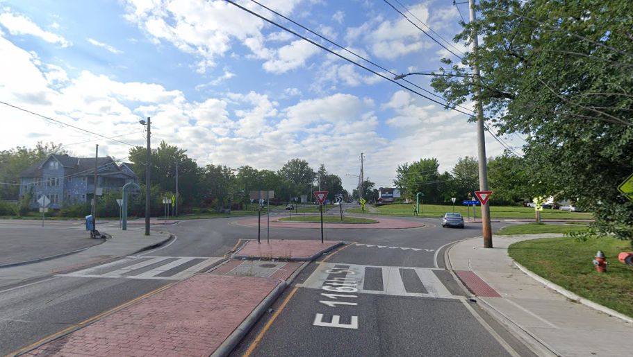
Mini-roundabout
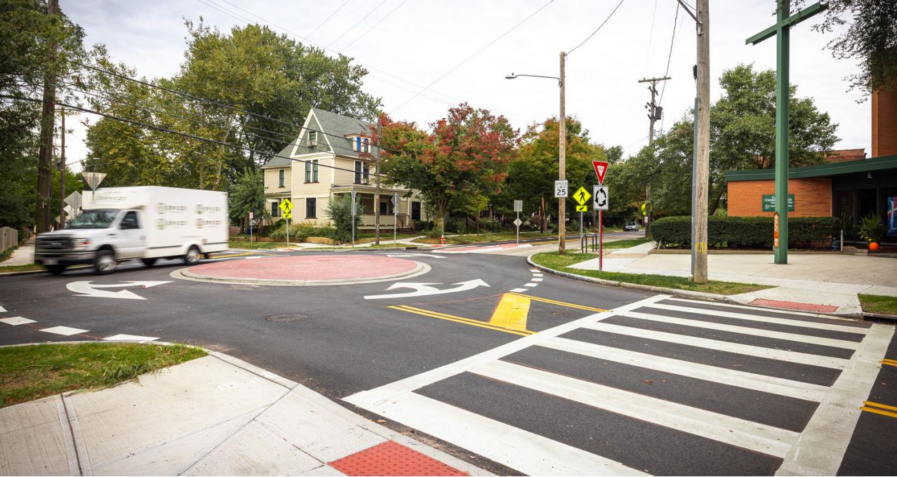
Mini roundabouts can increase safety at intersections, lower speeds, and make biking more convenient. We can replace low-volume traffic signals with mini-roundabouts.
Narrower vehicle travel lane
The width of vehicle travel lanes can vary depending on context. On a highway, lanes are typically striped wider to accommodate high speeds and large trucks. In an urban context - like in Cleveland - we can use narrower vehicle travel lanes to help slow vehicle travel speeds and make the street safer for everyone. Narrower travel lanes also open up more space for bike and bus lanes, wider sidewalks, or more trees.
Raised Intersection
A raised intersection is elevated to sidewalk level. This can increase driver awareness of crossings, slow vehicle speeds, and increase accessibility for people crossing the street.
Road Diet
A Road Diet reduces the number of vehicle lanes on a street. We will implement road diets citywide on streets that are on our high crash or bikeway network and streets with excess capacity. Most of our road diet projects will include bike or transit lanes.
Road diet outcomes can include:
- New dedicated left turn lanes that can reduce rear-end and left-turn crashes
- Reduced number of vehicle lanes creating a less complex road
- Shortened crossing distance for pedestrians
- Removal of excess capacity, resulting in safer speeds
- Space to install bike lanes, transit lanes, expanded sidewalks, or more trees or plants
Roundabout
Roundabouts are an alternative to a traditional intersection. They can:
- Improve safety
- Lower vehicle speeds
- Reduce conflict points
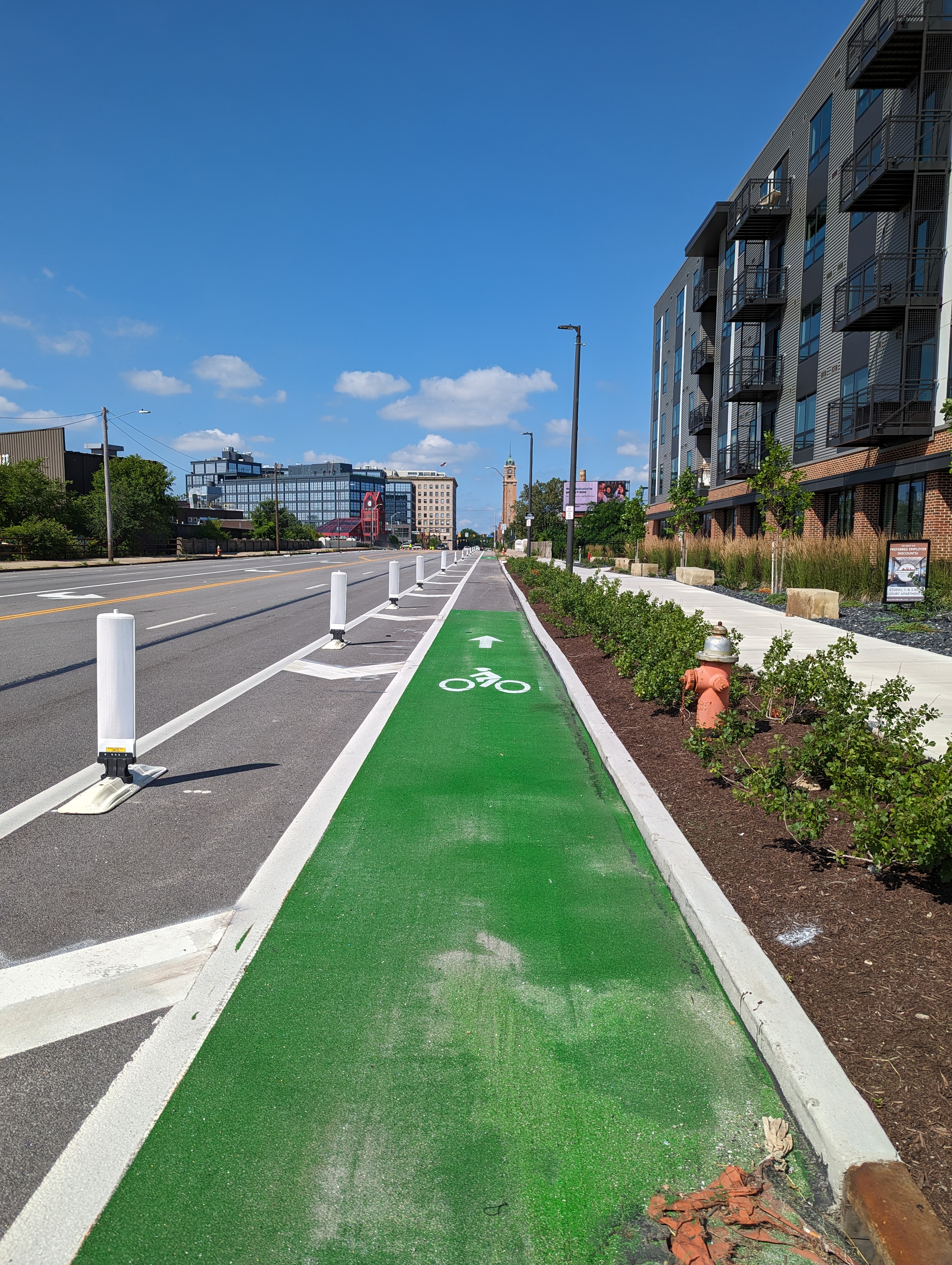
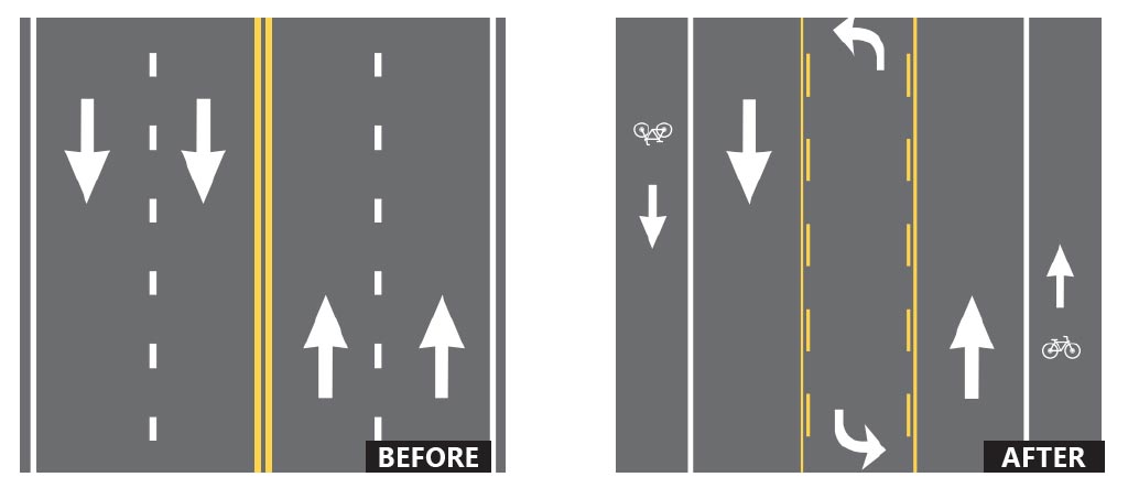
Separated Bike Lane
Separated bike lanes make the street safer for everyone using it, no matter how they travel. Physical separation increases comfort for people on bikes and on the sidewalk, while also visually narrowing the road for drivers which leads to slower, safer vehicle travel speeds. We can use different materials to physically separate bike lanes, including plastic flexible delineators and concrete curb or jersey barriers.
Speed Feedback Sign
A speed feedback sign displays vehicle speeds back to drivers to increase driver awareness of their driving behavior.
We already have speed feedback signs in University Circle and on Detroit Road.
Speed Hump or Speed Table
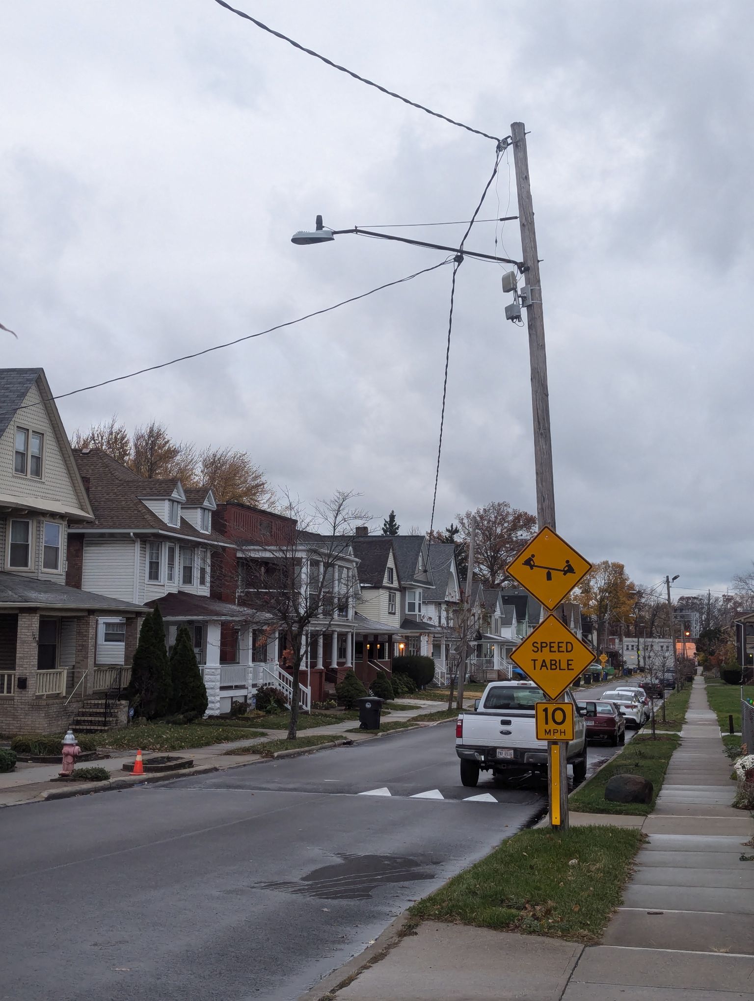
Speed humps are paved (usually asphalt) and approximately 3-4 inches high at their center, and extend the full width of the street. Speed humps are 12- to 14-feet long humps with a design speed of 15 to 20 mph.
A speed table is a term used to describe a very long and broad speed hump, or for a flat-topped speed hump.
We piloted 10 speed tables in 2022, and data showed that they reduced vehicle speeds on neighborhood streets by an average of 8 miles per hour. We installed our "first 100" speed tables citywide in 2024.
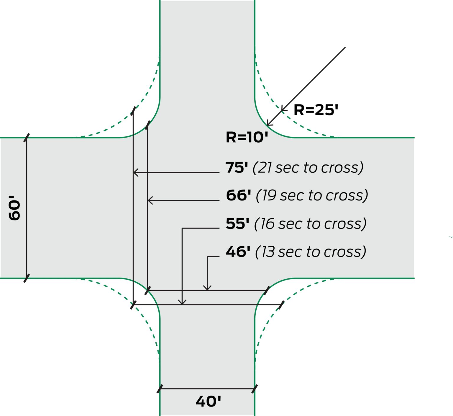
Tighter Turn Radius
Wide, sweeping turn radii allow drivers to maintain high speeds while turning, creating dangerous conditions for people crossing. We can tighten curb radii to better align pedestrian curb ramps with crosswalks, shorten crossing distance for people walking and rolling, and slow vehicle speeds to increase safety for everyone.
In Cleveland, we have significant industrial activity and have to balance truck activity - which requires larger turn radii - and pedestrian activity - which benefits from smaller turn radii.