We’re working to make it safer, more convenient, and more comfortable to get around Cleveland. Thank you for helping us develop Cleveland Moves, our guiding strategy for the next five years. 
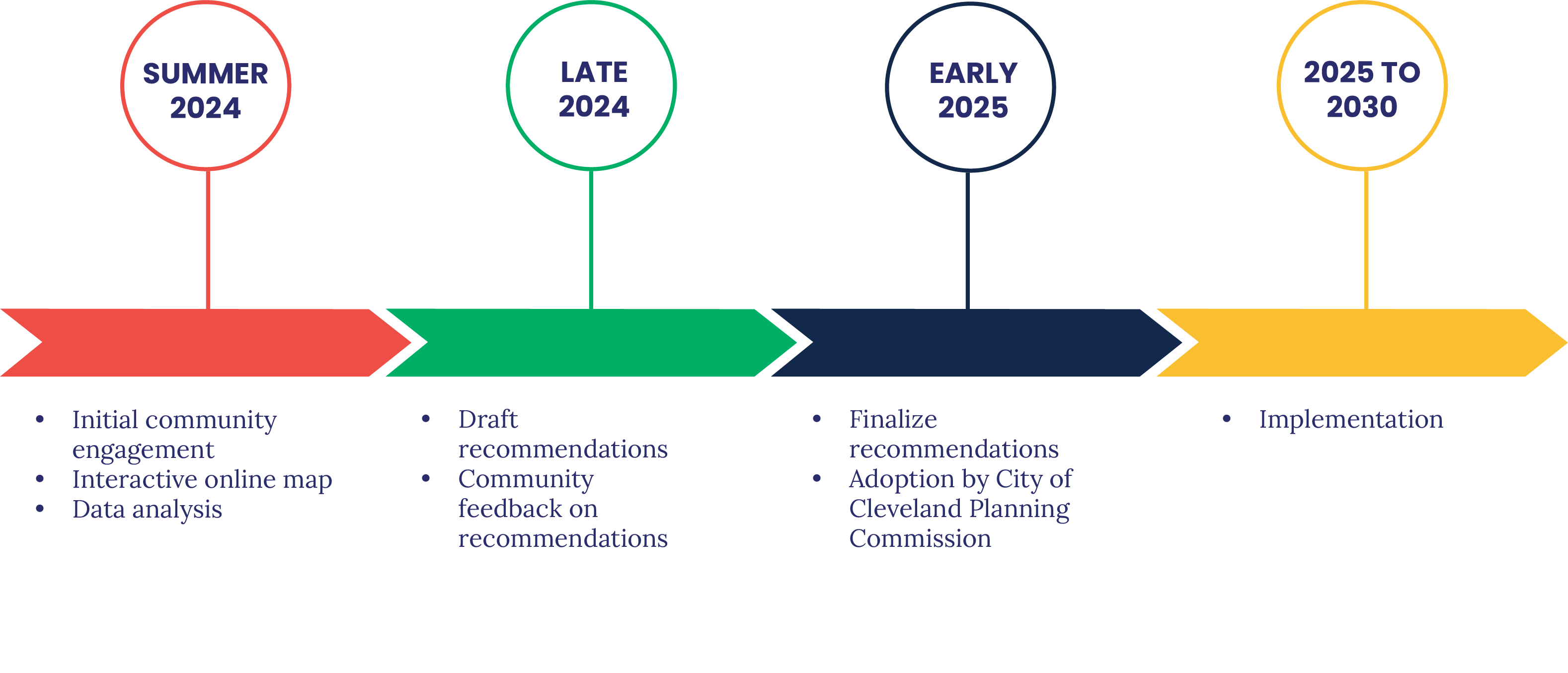
We spent summer, fall, and winter 2024 in the community listening to the experiences of Clevelanders and hearing feedback on our draft recommendations. We adopted Cleveland Moves in early 2025, and we've already begun implementation.
Recommendations
Our infrastructure recommendations include two parts - systemic safety recommendations and a bikeway network.
Systemic Safety Recommendations
Our systemic recommendations are citywide approaches to planning, engineering, construction, and maintenance. These are not tied to a specific street project. We will prioritize these changes on high crash corridors, in locations with high levels of pedestrian traffic, near key destinations like parks and schools, and as part of our other projects - whether they are bike focused or more standard resurfacing projects. Systemic practices include:
- Clear corners, or daylighting, near intersections and crosswalks to improve sightlines
- Signal timing changes, like shortening the length of cycles to reduce time spent waiting at a light for all road users, or giving pedestrians a head start to cross with a leading pedestrian interval
- Road diets, to reduce the amount of excess capacity on our streets - proven to reduce dangerous driving behaviors
- Crosswalk upgrades, such as installing pedestrian refuge islands and curb extensions to shorten crossing distances
Detailed summary of our systemic safety recommendations
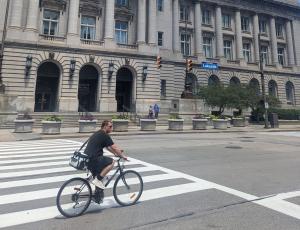
Bike Network
Bike lanes make streets safer for everyone using the street - no matter if they are walking, biking, on the bus, or in a car. We will build a connected network of high comfort bikeways that feel comfortable for people of all ages and abilities. This network will include a combination of off-road trails, low-traffic neighborhood streets (or neighborhood greenways), and physically separated bike lanes. Our network will also include our existing conventional bike lanes, upgraded to separated bike lanes over time where possible. Conventional (unseparated) bike lanes can still provide connectivity, but aren't considered appropriate for all ages and abilities in most contexts. Some of these facilities will be implemented over the next three years as part of our rapid, 3-year bikeway installation.
What will the next 3 years look like?
In 2025, we'll shift right into rapid implementation. We will:
- Build 50 miles of high comfort bikeways, including:
- Adding protection to existing wide bike lanes where appropriate
- Restriping and add new separated bike lanes – quick build
- Installing neighborhood greenways signage and markings; strategically complement with speed tables or other traffic calming
- Modify signal timing on 5 corridors or zones a year; audit and prioritize improvements for crosswalks in same zone
- Install centerline hardening at 10 intersections in 2025
- Continue with speed table installation citywide, installing over 100 more citywide in 2025
- Include systemic safety improvements in our bikeway and street projects
- Pilot safety improvements that have been proven in other cities
- Convert at least 150 parking meter poles to bike racks.
- Install over 70 shared mobility hubs.
Data Analysis
Project Updates
We attended community-based Better Streets Committee meetings across the City in February 2025 to share our draft recommendations and answer questions. Folks shared their top priorities and asked questions about proposed recommendations.
You can read a summary of what we heard in our engagement report.
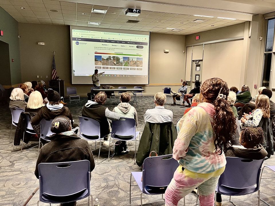
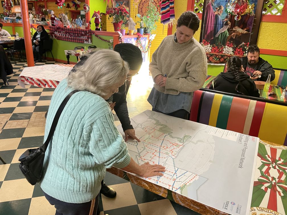
We shared our draft bikeway network and systemic safety recommendations for folks to comment on. People shared feedback through the interactive map and a survey. Responses included questions, top priorities, and more.
You can read a summary of what we heard in our engagement report.
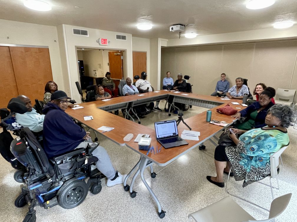
We held small group conversations to understand more about infrastructure and policy changes that could support the needs of residents. Conversations included folks who use mobility devices or had unique mobility needs, youth, Spanish speakers, and more.
We met with most groups twice. During the first round, participants shared frustrations and difficulties around transportation and answered questions about their top priorities for change. During the second round, we shared our specific recommendations for programs, policies, and bike facility types and locations. Participants gave us feedback and offered suggestions.
You can read a summary of what we heard in our engagement report.
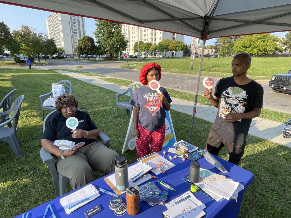
We connected with Clevelanders at summer events and festivals, holding pop-ups at local destinations and hosting virtual office hours weekly. You can still schedule a 15-minute virtual 1:1 call with the Cleveland Moves manager.
We were at summer events, including:
- Rediscover Veteran’s Memorial Bridge – June 22
- Slow Roll Public Square – June 24
- Bike Your Neighborhood – July 13
- Ward 4 Community Festival – July 20
- Disability Pride Day – July 27
- Summer Senior Walks – July 31 (League Park)
- Ward 14 Community Meeting – July 31
- North Coast Connector Event - August 5
- Summer Senior Walks – August 7 (Loew Park)
- Glenville Festival – August 10 (cancelled)
- East 55th Marina Summer Concert Series – August 10
- Summer Senior Walks – August 14 (Zone Rec)
- Slow Roll Voinovich Park - August 19
- Old Brooklyn Farmer's Market - August 22
- Mayor Bibb's Back to School Fest - August 24
- Plum Market - September 3
- West 29th Open Street - September 5
- Marshall Avenue Safety Fair - September 7
- Kamm's Corners Farmer's Market - September 8
- Food for All Market at Euclid Beach - September 13
- FreshFest Cleveland - September 15
- March for Access - September 21
- Virtual Office Hours - Weekly on Wednesdays, 4-7 PM
You can read a summary of what we heard in our engagement report.
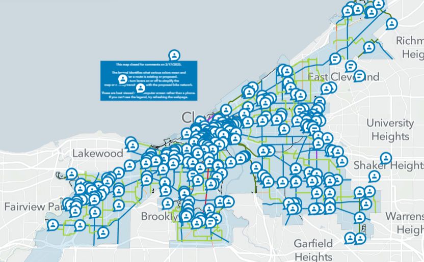
We created an interactive map where Clevelanders shared walking, biking, and rolling routes. People also highlighted important destinations and barriers that make trips more difficult.
We also referenced feedback received through other previous online map activities and processes, including:
- City Neighborhood Traffic Calming Request Form
- NOACA's Regional Active Transportation Plan, ACTIVATE
- Downtown Cleveland Transportation and Livability Study
- Ohio City Mobility Study
- Vision Zero Action Plan
You can read a summary of what we heard in our engagement report.
We analyzed our existing transportation network to understand key areas for improvement and track our progress over time. This analysis included:
- Crash analysis, to see where and how most crashes are happening
- Bicycle Level of Traffic Stress (BLTS), to see what streets are best for biking already and what streets will need more significant changes to be comfortable
- Crossing Stress, which will help us prioritize which crossings should be improved first
Review a detailed summary of our data analysis, or explore datasets for Cleveland Moves on our Cleveland Open Data network assessment dataset.
Project Outcomes
Cleveland Moves: Cleveland’s 5-year Multimodal Transportation Plan achieves multiple objectives, including:
- Update the 2007 Bikeway Master Plan to recommend a connected bike network that complements the GCRTA transit network for riders of all ages and abilities for 3-year rapid implementation
- Build on the Vision Zero Action Plan by taking a deep dive into bicycle and pedestrian safety issues to identify priority investments to make walking and rolling safer and more comfortable for everyone
- Review existing programs and policies and address gaps related to walking, rolling, and riding bikes
- Develop the look and feel of the Midway Bikeway Network
- Integrate ongoing projects and new recommendations into a 5-year prioritization and implementation plan
Background and Context
Cleveland last updated its bikeway plan in 2007 - and a lot has changed since then. You can read more about our recent transportation history, progress, and vision in our interactive report.
Our Complete and Green Streets Policy requires us to update our multimodal transportation plan every five years, starting with Cleveland Moves 2025. Community engagement and data analysis began in summer 2024, and we adopted the plan in April 2025.